Words of Wisdom from SharLeigh
BATTEN DOWN THE HATCHES!
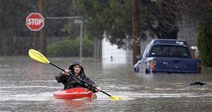
The National Oceanic & Atmospheric Administration (NOAA) is the government agency that monitors and predicts changes in our weather and environment. NOAA scientists have observed that the conditions are ripe for a strong El Niño condition this winter. Several events need to occur to create an El Niño event. First, the trade winds need to weaken. The trade winds are tropical winds that constantly blow through the tropical and subtropical areas of the earth. In the Northern Hemisphere, the winds blow from the northeast and in the Southern Hemisphere from the southeast. Once these trade winds weaken, it flattens out the sea and allows warmer western Pacific water to flow east. This causes the warm water on the Indonesia coast to flow towards South America – and dramatically changes the temperature of the ocean in this area. The warmer water causes hot, humid air to rise over the ocean, creating optimum conditions for tropical thunderstorms. The Eastern United States may notice a decrease in hurricane activity and the winter may be milder, but the west coast, especially California, could see massive winter rains. The last El Niño winter, which occurred in 1997-1998, brought with it landslides and flooding throughout the state. Some scientists believe that the El Niño event is related to global warming (higher temperatures increase evaporation and add moisture to the air, therefore intensifying thunderstorms), but other scientists disagree. Many scientists believe that the El Niño condition is simply a cyclical pattern in the ocean. Since the sixteenth century, the coastal fishermen of South America have observed these patterns, which still persist today. But no matter what your beliefs, we are facing a possibly strong El Niño event in California this winter. Please make sure that you are safe by packing your trunk (or truck) with essentials like water and a flashlight – a new pair of windshield wipers might help, too!
